| ||||||
|
EyeShotRather than rely on the same ZIP code-based information as your competitors, EyeShot® customizes its results according to your individualized business needs.
Synthegis' decision tool EyeShot® customizes geographic catchment areas as dictated by your storefront - not the post office — to provide updated analysis and relevant forecasts that reflect what is really happening in and around a specific location.
Localized Information - Defining trade areas by ZIP code may not give you the specific, updated information you need to understand what is happening with your storefront. And defining customers by linking macro demographic information gleaned from residential ZIP codes further lessens the validity of the information.
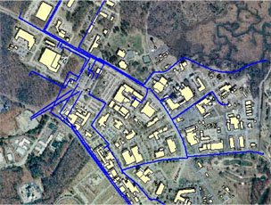
But EyeShot® uses what we call "ground-truthing" to take an intimate snapshot of your business - incorporating local elements that may include foot traffic by time of day, zoning permits and other nearby businesses.
This microsegmentation provides a holistic, accurate and dynamic snapshot of your location, moving you well beyond the static ZIP code-aggregated data used by your competitors.
Advanced Analytics - EyeShot's advanced database management system uses proprietary predictive analytic methods and geostatistical analysis to process your business intelligence.
Users can define queries, query across multiple categories, conduct searches, forecast, retrieve data and ultimately display results geographically, turning layers on and off as necessary.
User-Friendly - EyeShot® is based on an intuitive, one-window approach that generates meaningful visual information and analysis from existing intelligence. Managers - not just statisticians and GIS analysts — can easily understand and distribute information between departments and across corporations. Accurate and Up-to-Date - Data are refreshed regularly, ensuring accuracy and reliability. |